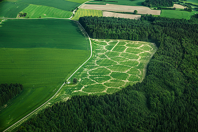
Created by Benedikt Groß, Avena+ Test Bed is a project that explores the relationship between landscape, agriculture and digital fabrication by intercepting the process of precision farming by generative design. The emphasis of the project lays in speculating about new models which would enhance current agricultural practices, and to then imagine their possible implications.
With the advent of Precision Farming, agriculture has become fully mapped and will transform farming to a highly digital activity. This in combination with other changes underway in the countryside, mainly the paradigm shift from food to biogas production and various EU subsidy schemes to promote diversity, will lead to disruptive changes within the next few years for the (European) countryside.
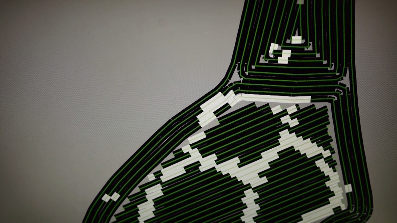
The project uses the idea of “Agricultural Printing” to explore the possibilities of digital fabrication carried over into farming. The experiment applies algorithms to partition and to create an environmentally beneficial arrangement of plantation to establish, or improve, the connectivity for fauna and flora between habitats.
This increased diversity also eases typical problems of monocultures e.g. less vermin → reduced usage of pesticides. Furthermore a farmer could “rent out” the areas for several months a year as compensatory area in the same fashion like the CO2 emissions trading scheme works (in the EU every new land for building has to be compensated). Hence in the near future a farmer might not just produce oats, peas, beans and barley, but also print “environment compensations areas” into his fields.
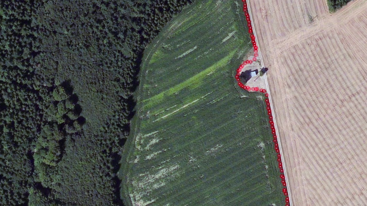
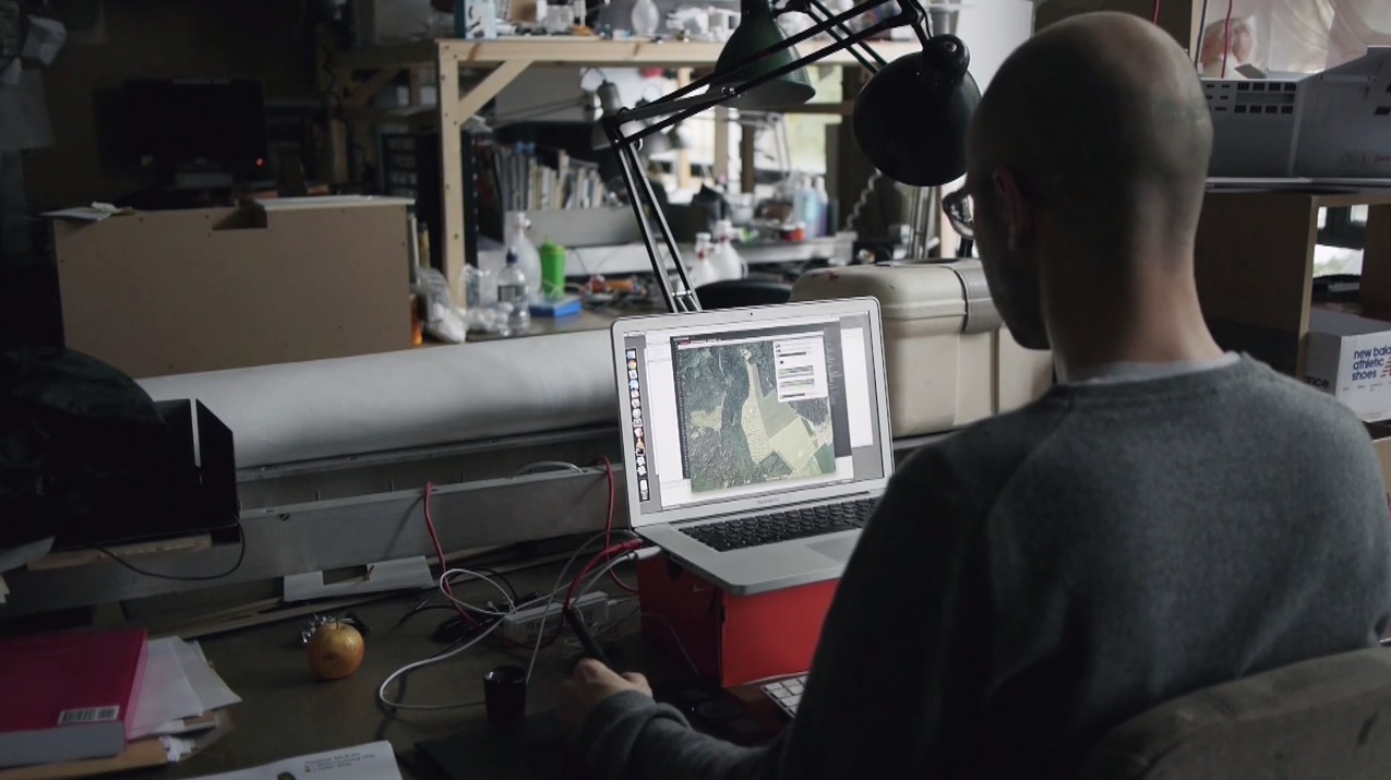
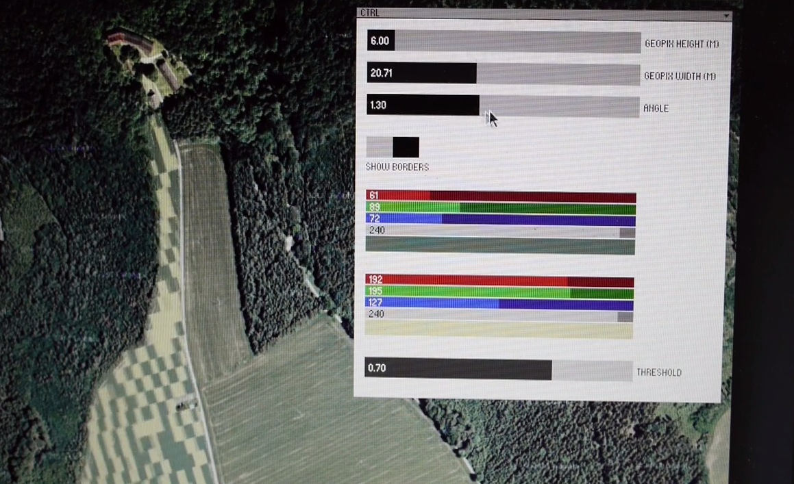
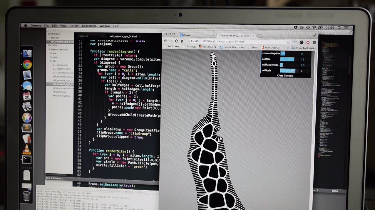
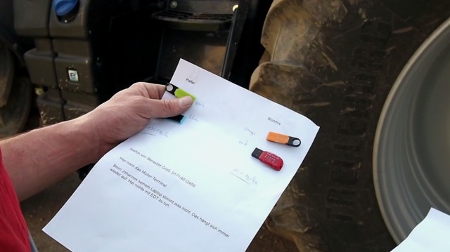
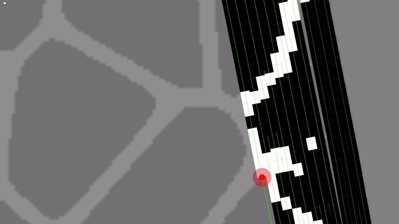
The process included conversion of circumference points to area/polygon with a python script and then exported to a geojson file. Fine tuning of the bounds.geojson file was done in QGIS and illustrator (Benedict had to write an importer/exporter). The new pattern was generated in paper.js, based on bounds.geojson and exported to svg and png. Custom Processing sketch baked the bounds.geojson and the pattern.png (with a pixelsize of 3 mx 3m) to a “print file” for the tractor. There was one file for each “color”: oat seed and flower/herb seed mix. The final oat.geojson and flowers.geojson were converted to shapefiles in QGIS. These files were then imported (oat.shp and flowers.shp) to “Farmworks” (= the CS Suite of a farmer, to convert everything to agricultural machinery speak binary files.
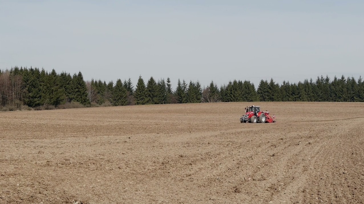
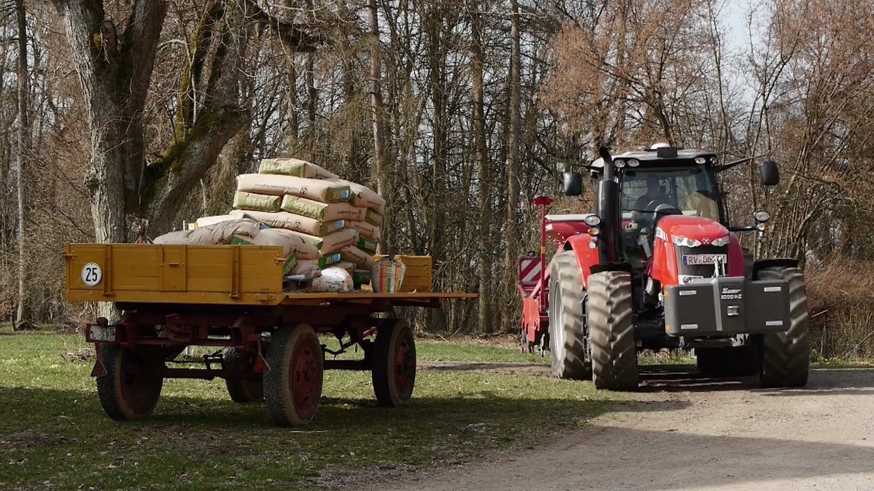
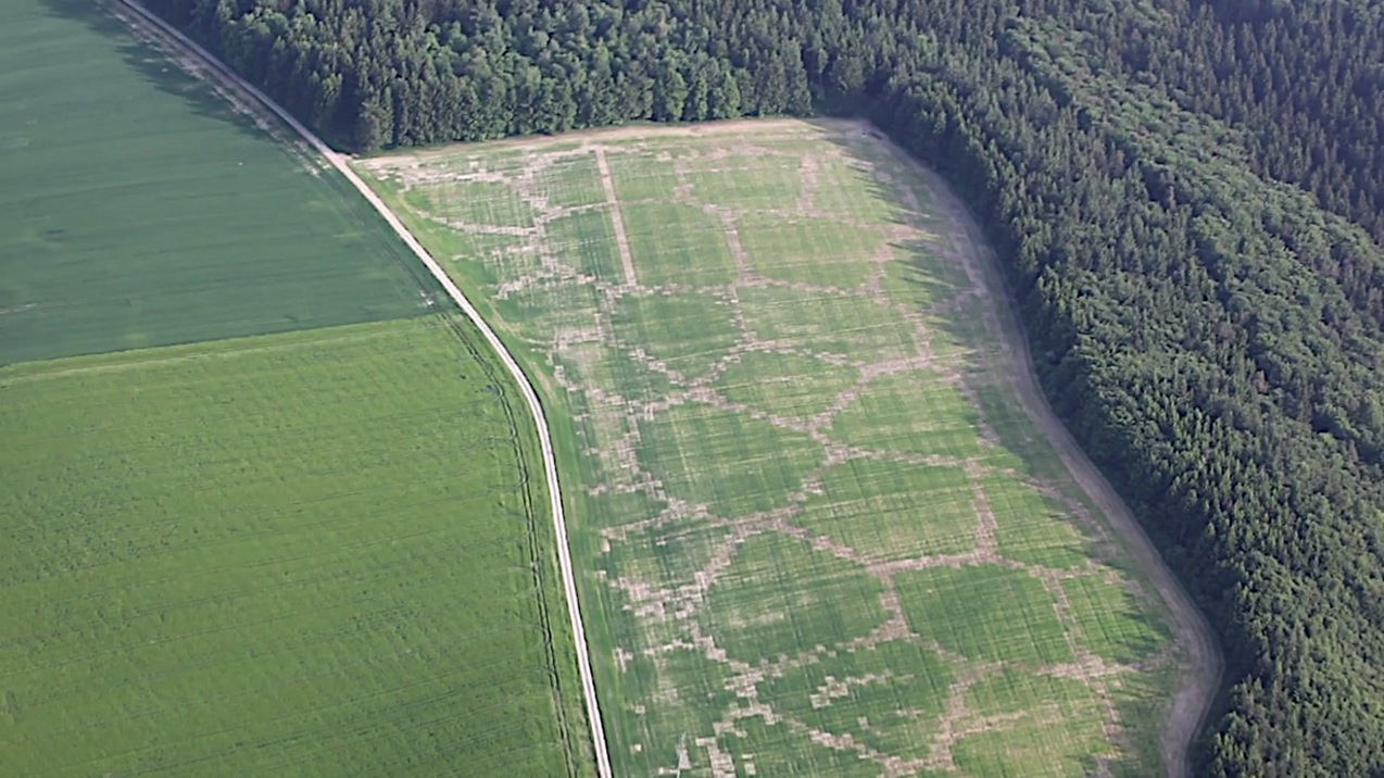
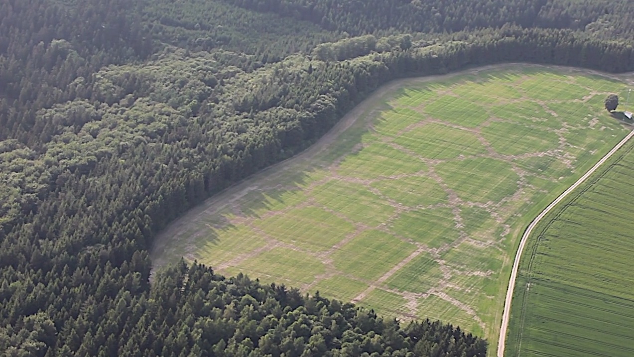
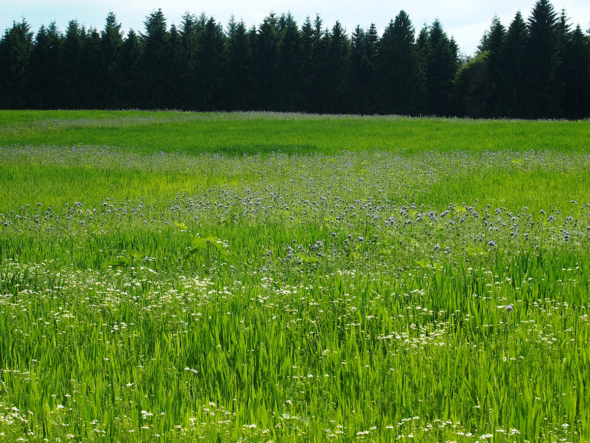
The circumference of the plot is recorded on site using GPS coordinates. 11.5 hectares (320 m x 920 m) in Unterwaldhausen, South GermanyBenedikt uses the data collected to devise best algorithm for the plot division and route planning.The data is provided back to the farmer contained on USB memory sticks. Location mapping is done using External GPS/GLONASS reference station for maximum accuracyThe planting process simulation.Mid-Final result. 85% oats (Avena Sativa), 15% eleven different flowers and herbs. Photo of the test bed, flowers are hardly visible (end of May). By the end of July 2013 the test bed will be harvested to produce biogas.Picture taken in July 2013
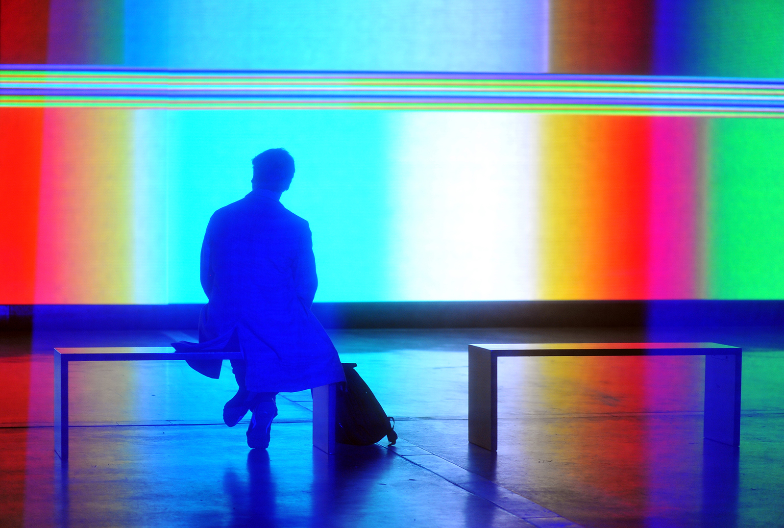
Several prominent currents run through the oeuvre of Montreal’s Matthew Biederman – data systems, politics, broadcast media, performance and the promotion of awareness of northern landscapes and cultures. Another interest that is evident across Biederman’s body of work is colour, a fascination that he demonstrates an almost painterly preoccupation with within several of the installations that…
Sorry, this is Members Only content. Please Log-in. Join us today by becoming a Member. • Archive: Access thousands of projects, scores of essays, interviews and reviews.• Publish: Post your projects, events, announcements.• Discuss: Join our Discord for events, open calls and even more projects.• Education: Tutorials (beginners and advanced) with code examples and downloads.•…
Created by Ernst Uys, Sablo for iOS lets you explore the boundary between order and chaos using the Abelian Sandpile model (also known as the Bak–Tang–Wiesenfeld model) in theoretical physics.
Sorry, this is Members Only content. Please Log-in. Join us today by becoming a Member. • Archive: Access thousands of projects, scores of essays, interviews and reviews.• Publish: Post your projects, events, announcements.• Discuss: Join our Discord for events, open calls and even more projects.• Education: Tutorials (beginners and advanced) with code examples and downloads.•…
“The main change in the design process achieved by using generative design is that traditional craftsmanship recedes into the background, and abstraction and information become the new principal elements.”
3 comments on “Avena+ Test Bed – Agricultural printing and altered landscapes”
Since its inception in 2008, CreativeApplications.Net has been a driving force, tirelessly influencing and shaping the conversations surrounding technology, society and critical making. With a vast library of over 3,500 meticulously curated projects, it serves as a beacon in the ever-shifting landscape of creative exploration and innovation.
As a member, you can access all content on CAN, post your own projects, join the conversations, and enjoy ad-free reading!
Your support also ensures we keep the site as ad-free as possible, allowing us to focus on what we do best: showcase amazing work. Above all, you will join because you believe in the value of CAN and wish to see it thrive for years to come.
We use cookies to ensure that we give you the best experience on our website. Please be aware that your experience may be disrupted until you accept cookies.OKNoRead more


Intriguing!
I think some times artist make great poster without any planning and this is one of them.The information you provide for test bed is worth to read.
I think some times artist make great poster without any planning and this is one of them.The information you provide for test bed is worth to read.