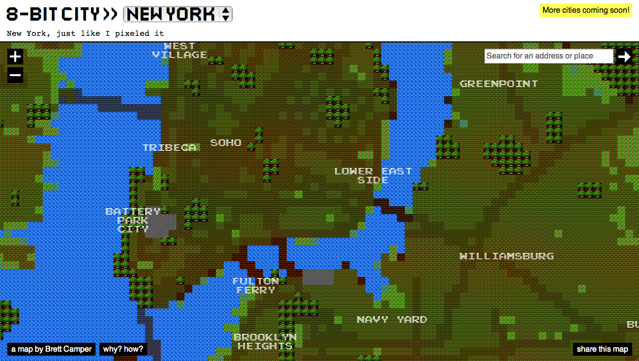
Created by by Brett Camper, 8bit mashed together with Open Street Maps result in this alternative city maps of different metropolises: New York, Paris, Berlin, London and Amsterdam.
The 8-Bit Cities project, which started with 8-Bit NYC, is an attempt to make the city feel foreign yet familiar, smashing together two culturally common models of space: the lo-fi overhead world maps of 1980s role-playing and adventure games, and the geographically accurate data that drives today’s web maps and GPS navigation. I hope to evoke the same urge for exploration, abstract sense of scale, and perhaps most importantly unbounded excitement that many of us remember experiencing on the Nintendo Entertainment System, the Commodore 64, or any other number of 8-bit microcomputers. Maps offer us visual architectures of the world, encouraging us to think about and interact with space in particularly constrained ways. Take some time to think about your surroundings a little differently. Set out on a quest. Be an adventurer.
The maps were created using a custom rendering engine with underlying geometry that comes fro OpenStreetMap and contributors CC-BY-SA. The pixel fonts are by the artist Miffies (with some modifications). The map graphics are assembled in Python: for each 16×16 pixel tile, a series of spatial tests are performed via SQL/PostGIS. Based on the results the appropriate bitmap tile is selected. The bitmaps are then tesselated into larger 256×256 pixel tiles, and served to your browser.
(via digitaltools)