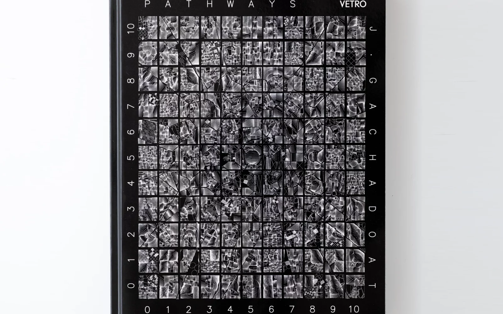
Benedikt Groß’s work is frequently noted here on CAN, so far in 2013 we’ve posted three of his projects. Since executing his inventive Avena+ Test Bed, which ‘programmed’ the biodiversity of a South German agricultural plot, he’s teamed up with an American cartographer to develop The Big Atlas of LA Pools. With this recent project, he’s leveraged satellite photography, crowdsourced offshore labour and the artist’s book medium to catalog every pool in Los Angeles (across a whopping 74 books and 6,000 pages). Given our ongoing coverage of Benedikt’s practice, we thought a conversation about some of the interests driving his work was in order. The following edited transcript documents a dialogue that has taken place via a Google Doc over the last several weeks.
The Big Atlas of LA Pools is a very specific project in terms of its subject and the workflow you’ve created. While much of your recent work has explored cartography and aerial imagery, how exactly did you end up selecting Los Angeles as a site of consideration?
During a trip to California in February 2012, I was intrigued by some of the idiosyncratic details in the urban landscape, most especially by the crazy number of swimming pools in Los Angeles. I can still remember the view from the plane while I was flying in, I had never seen so many pools! I was deeply impressed as the city was supposed to be desert and not a swimming pool landscape. This combination raised the question in my mind: How many swimming pools might L.A. have? So I had to put this burning question on my ‘to do’ list.
Nothing happened for six months and then I met Joseph K. Lee in Boston during an internship at MIT’s SENSEable City Lab. Joey’s background is geography, remote sensing, GIS and skateboarding. During a lunch conversation I brought up that question, “how many swimming pools are in LA?” and Joey, as an LA local, was immediately keen to look into it. His response: “I have no idea how to do it, but let’s get some high resolution satellite imagery and figure it out!”

So the project started out as a quick experiment. We were super confident that this would be a piece of cake: a little bit of computer magic to detect all blue swimming pools in a similar fashion to photoshop’s magic wand tool and voila! Of course it turned out to be a nightmare, all automated computer vision approaches ended up producing nothing but digital glitch.
At around the same time, I stumbled across online services in India for doing clipping paths. Those services clip out product images for the typically ‘product in front of white background’ for online shops. So I thought maybe the ‘human crowd sourcing brute force’ approach could help us. It has taken us quite a while to figure on the right service, instructions etc. to re-train a clipping path service for geo-spatial tracing of swimming pools.
When we finally received the 15GB of satellite imagery and approximately 64,200 carefully traced bezier paths of potential pools, we had bad pangs of conscience! We had expected a lot less work on their end, and we also didn’t pay that much of a fee. At the same time this gave us the feeling that this project was really interesting: cute swimming pools in LA to cheap labour exploitation and photoshop sweatshops in India seemed to be quite the journey. From then on we decided to take the project really seriously and push our research question as far as possible.

To what degree were Ed Ruscha’s serial photography projects (e.g. Every Building on the Sunset Strip, Thirtyfour Parking Lots, etc.) and corresponding artists books an inspiration for the publication you produced to document this work?
Zero! Simply because I am super terrible when it comes to art history. I actually didn’t know about and Ed Ruscha until Hans Ulrich Obrist visited Design Interactions, I was a lucky one who was asked to gave him a work-in-progress presentation. He (and his three assistants) just couldn’t believe that I was not familiar with Ed Ruscha’s work. It was big laugh after HUO asked that question and I replied “Who’s that?” He pointed at me while chuckling, “Ed is your ancestor!” But so as to not completely embarrass myself, I have to say I was aware of David Hockney’s works and especially Frank Perry’s 1963 film The Swimmer which was a great source of inspiration. The plot is basically a man imagining he can swim home, pool by pool, forming a ‘river’ to his house. The video part of the LA Pools project. The LA Swimmer is a direct reference to that idea. We imagined we might be able to make an allusion to the vision of a ‘river of pools’. However instead of a journey of self-discovery, we instead invite the viewer to leap-frog from pool-to-pool and to see LA through the Google’s street view camera.
Speaking of abstractions of landscape, cartography appears to be one of the practices you return to regularly within your work. In the past you’ve reshaped London based off the tube map and developed software for visualizing sea level projections. Could you share some of the thinking behind your ongoing experimentation with map making?
True, I am really drawn to geography and maps. I actually started my days as a student with a combination of geography and computer science, but dropped out after a year of disappointment. At that time I was naively looking for a kind of an ‘universal domain’ which could connect everything to everything, where the intersection between disciplines becomes the core of the discipline. Which is funny, because the motivation to study geography in the first place, became then my main inspiration to change to design. But I still believe that geography and design are brothers in mind, especially after working with Joseph K. Lee on the Big Atlas of LA Pools. The project strongly renewed this feeling: both disciplines are a wild mix of topics and approaches, and tick pretty much the same way!
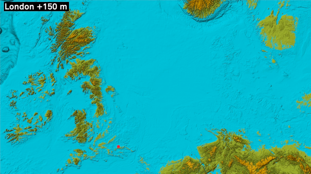
My recent fascination with maps started with MapMap Vauxhall where I was once again reminded what a powerful device maps can be. I think we are most of the time not aware that besides the obvious aspects of navigation and mapping, that there is always also a subtle but constant conditioning going on while someone is using a map. Or as my favourite Marshall McLuhan quote states: “First we shape our tools, thereafter they shape us.” And with the increasingly importance of online maps e.g. Google Maps, Microsoft’s Bing, Nokia’s here.com etc. you could even argue that people perceive more and more large extents of ‘their reality’ through these mediums. With that in mind and the ambivalence of ‘it is on a map, so it has to be true!’ Maps are such a great (contemporary) tool to craft all kind of believable fabrications and imaginations. But I suppose a map like the one above best summarizes my point.
Avena+ Test Bed makes a pretty compelling argument for the application of generative strategies to agricultural design. How does the algorithm you developed calculate how much biodiversity to introduce into a plot and how it is distributed spatially?
The algorithm tries to partition the field in various ways. The oat patches, for instance try to mimic the sizes of old fields (field sizes before mechanization) apparently that size was a more sustainable one. Or the flowers/herbs patches are optimized to increase the interconnectivity between habitats of different species, and embrace the production areas to reduce problems with vermin. In theory, some flowers/herbs exude pheromones which make vermin avoid those areas, so farmers have to use less pesticides. You could say the design tries basically to ease the typical problems of monoculture/energy production fields … but in this context, I want to point out that the project is a design proposal and is not hard science quantify one. I designed the pattern in a plausible way after some feedback sessions with people from the agricultural science scene. Quantifying and measuring the actual impact would be the next step.
But my main intention is rather to speculate around possible future landscapes. During the process of making the project happen, I had a lot of interesting conversations with people from the agricultural domain. Three particular interesting topics emerged during those conversations: precision farming, a paradigm shift from food to energy production, and the powerful EU subsidy scheme. The conversations about precision farming were particularly inspiring. Precision farming is the buzzword for digitization in agriculture, the last fifty years everything in farming was about increasing efficiency in terms of scale, now the next big thing is digitization. Which made me think that a farmer a few years might be a person in front of a computer in an office literally programming landscape. Hence maybe a better metaphor of growing crops in the future might be the one of a ‘digital printing’ workflow. With that in mind is was keen to come up with a scenario embracing the three topics in an as plausible as possible way. I am especially interested in the near future and not so much in distant sci-fi vision etc.
I have settled down to an energy production field, because there it no longer matters whether the crop is as pure as possible, in the end many different crops are thrown together to be converted to methane gas. Hence it seems more plausible to mix the crops on that kind of field. Or for the seed mix of the herbs and flowers I’ve used you can get already today subsidies from the EU etc.
So I believe the field is a very plausible illustration of how our landscape could look like within the next fifteen years. I hope to kickstart a broader discussion with the project.

You mention the topics you discussed with various agriculture stakeholders, but what was the tone of these interactions? Were farmers, or administrators, or technologists in this, er, field, open to your ideas or were they cautious about the plausibility of what you are proposing?
I just can speak of course for South Germany/Europe … But I was very surprised how open all the stakeholder in this domain seemed to be, especially Farmers are generally very open to technology in my experience. I think they are just very aware that they make their living with a by men curated nature, which involved over centuries always a lot of technology. Just go to a website of an agricultural equipment manufacturer e.g. agcocorp, there is a high chance that the landing page will look quite futuristic, or there are even the typical corporate future vision scenario videos around e.g. Farm Forward by John Deere. Hence I think it is safe to say that farmers know what is going on in the world of technology. Same goes for technologists in that realm, I could immediately connect with them talking around the best API to map out a field with a high-tech tractor GPS and GLONASS etc.
In most conversations it came basically down to two things: 1) how can you increase profit/efficiency? and 2) will a change in practice still be sustainable over a long period of time? You better have an answer for them! So I had to carefully craft my project around those central questions, among others.
And I suppose the basic principles with a project which involves a lot of people stay always similar: be friendly, have a lot of conversations, listen, get to know the people and domain knowledge, understand their issues and concerns … and last, try to incorporate all the input to something interesting/new. The tricky bit is to balance the new and the domain specifics in a way, that people from the domain don’t feel detached and people from outside can easily connect to it e.g.: for the agricultural technologists avena is just a gigantic feasibility demo of 3m x 3m pixels, for a farmer an idea to make field more sustainable, for administrators a way to compensate sealed ground of new building land and a designer might just like the aesthetic dimension of the project.
How was waiting to see the field grow in, were there any unanticipated surprises in the way the plot sprouted up?
Good! But as a old country boy living in the city I think it was not a particular or an exotic feeling for me. I was always very aware that agriculture is literally shaping our landscapes and at least in most parts of Europe there is no ‘untouched’ nature, everything is a man-made cultural landscape.
However plants are definitely a different material than code! You have to treat them well, and you have to go with the flow of the weather and the seasons. Furthermore I was surprised how much help I needed in the end as a non-farmer. Because of that I would say the project was to a large extend a logistic project. I had to convince someone to borrow me the land, in my case 11.5 ha of land from the local Count of Königsegg-Aulendorf, to put that in context the harvest of such field is about €15,000—€20,000 per harvest. So it was clear that I had to find ways to integrate my proposal in a way that there was not a total loss in terms of yield. I also had to ask some companies for intermittent access to €170,000 of R&D machinery.
Plus I had a lot of the normal ‘things always go wrong’ surprises like: the coldest and wettest March since 1885, snow in April (extremely unusual) when I booked the R&D equipment, or that the professional €15,000 drone I booked for documentation crashed during the first session, etc.
But besides that, seeing the crops growing saw me pause in contemplation and have a very good feeling, also it takes ages to grow things. Standing on the field, surrounded by 3 x 3m flower ‘pixels’ was just a beautiful experience.

Ok, time for some full-on speculation! Given your experiments with programmed landscapes, what are some other larger-scale environments or industries where you think generative strategies might be deployed?
Generously ignoring the issue of ‘what is exactly generative design?’, I think we will see generative strategies all over the place in the near future. I see two main reasons for this: data and 3D printing.
Everything what can be printed will be printed! To some extend this is already true, just think of today’s possibilities: from DNA printers, to jewellery or highly controversial printed objects like guns, to robots ‘printing’ a high rise building. In addition, the relative price of 3D printers is now roughly there where laser printers have been before the DTP revolution, and laser printers in combination with new software were the major drivers for the disruptive changes in the late 80s. All this will lead to large-scale changes for mass production and the related distribution. It will basically turn the way we define the concept of a consumer product and related industries upside down. The ‘product’ in the future might become just a kind of 3D template or even more something along the lines of a generator to start a parametric design process to incorporate the differs requirements of consumers. I’m not talking about customizing the newest sneaker online with a different swoosh color … I think that products might be access to a bunch of algorithms that come along with the newest super fancy printing material to produce your A trendy sneaker at the corner 3D print shop.
Another intriguing development for me is quantity of new data created every day by all of us. There are already fields where the economic value is mainly based on data, think of the Open Data initiatives all over the globe or the idea of the Internet of Things. In all those developments generative strategies are to some extend involved. And speaking of data in the sense of information, I believe that information visualization in general will become a commodity running through our everyday life, of course powered by generative design strategies.