Hello Visitor!

Creativeapplications.Net (CAN) is a community of creative practitioners working at the intersection of art, media and technology.
Login
Status
Register | Forgot Password
Online for 6,613 days (18 years, 1 months, 8 days), published 4,232 articles about 2,995 people, featuring 219 tools, supported by 1,740 members, and providing access to 460 students.
Categories
CAN (95) Education (32) Event (253) Member (352) News (885) NFT (256) Project (2635) Review (46) Theory (54) Tutorial (39)
Log
Links

API for using Google Maps and integrating it into your own projects https://developers.google.com/maps/documentation
Title Excerpt Metadata Color
A Map of Algorithmic / Random Walks
A visual map project that contrasts algorithmic navigation with chance-based wandering, combining data from both to create layered diagrams and 3D-like city mappings that reveal London’s hidden patterns and alternate urban narratives.
Invisible Network – A ‘social network’ for the machines
'Invisible Network' is a portable device that makes communication between machines perceptible and tangible. This device acts as a mediator between the user and the machines that surround him. Through its screen, it indicates the relations that it...
Modern Map Art – Deconstructing, filling and restitching maps
Created by David Hoe (Mini Cloud Studios) from London, and currently on Kickstarter, 'Modern Map Art Prints' is a collection of detailed maps transformed into colourful abstract art prints of anywhere in the world. The project celebrates the joys ...
Indirect Flights – Sprawling landscape of layered images
Raw materials, satellite images, organic textures, brush strokes and architectural fragments are all blended together into a dense Google Maps style panorama extending in all directions.
Playground NDSM – Interactive photomontage of 7 years at NDSM-warf / Amsterdam
Created by Marc Faasse, Playground NDSM is an interactive photomontage that includes 7 years of photographs taken by Marc and mapped on the googlemaps.
  • D14/05/2014
  • A@Filip
  • C
  • T,
  • Maps by Kim Asendorf – Colour and Topography
    Kim Asendorf uses Google Maps to explore incomprehensive complexity of landscape as colour and pattern.
    Livehoods – Use-based urban analytics
    Livehoods is a new project hatched within the School of Computer Science at Carnegie Mellon University that leverages 18 million Foursquare check-ins to draft up new urban 'activity zones' based on the patterns of frequent visitors. The venture es...
  • D16/04/2012
  • A@greg
  • C
  • P
  • T,
  • A Map of Algorithmic / Random Walks
    A visual map project that contrasts algorithmic navigation with chance-based wandering, combining data from both to create layered diagrams and 3D-like city mappings that reveal London’s hidden patterns and alternate urban narratives.
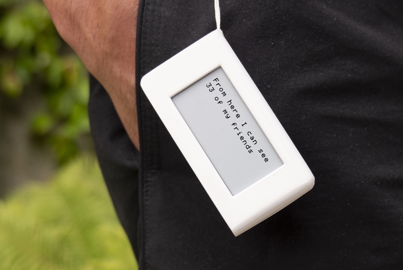
    Invisible Network – A ‘social network’ for the machines
    'Invisible Network' is a portable device that makes communication between machines perceptible and tangible. This device acts as a mediator between the user and the machines that surround him. Through its screen, it indicates the relations that it maintains with its personal environment.
    Modern Map Art – Deconstructing, filling and restitching maps
    Created by David Hoe (Mini Cloud Studios) from London, and currently on Kickstarter, 'Modern Map Art Prints' is a collection of detailed maps transformed into colourful abstract art prints of anywhere in the world. The project celebrates the joys of travel and the unique fingerprint of every city from above – it is a crossover of modern maps and...
    Indirect Flights – Sprawling landscape of layered images
    Raw materials, satellite images, organic textures, brush strokes and architectural fragments are all blended together into a dense Google Maps style panorama extending in all directions.
    Playground NDSM – Interactive photomontage of 7 years at NDSM-warf / Amsterdam
    Created by Marc Faasse, Playground NDSM is an interactive photomontage that includes 7 years of photographs taken by Marc and mapped on the googlemaps.
  • D14/05/2014
  • A@Filip
  • C
  • T,
  • Maps by Kim Asendorf – Colour and Topography
    Kim Asendorf uses Google Maps to explore incomprehensive complexity of landscape as colour and pattern.
    Livehoods – Use-based urban analytics
    Livehoods is a new project hatched within the School of Computer Science at Carnegie Mellon University that leverages 18 million Foursquare check-ins to draft up new urban 'activity zones' based on the patterns of frequent visitors. The venture essentially asks how does a location-based service reflect our sense of place within the city?
  • D16/04/2012
  • A@greg
  • C
  • P
  • T,
  • 1-14 of 14

    Titles A Map of Algorithmic / Random Walks
    A visual map project that contrasts algorithmic navigation with chance-based wandering, combining data from both to create layered diagrams and 3D-like city mappings that reveal London’s hidden patterns and alternate urban narratives.
    , A Heart from Space – A tool for colle...
    Created by Jonathan Chomko, and inspired by a conversation with Yo-Yo Ma around a performance of a previous work, ‘A Heart from Space’ is a tool for collective GPS drawing. To draw together, gather a group of of people and visit t...
    , Invisible Network – A ‘social n...
    'Invisible Network' is a portable device that makes communication between machines perceptible and tangible. This device acts as a mediator between the user and the machines that surround him. Through its screen, it indicates the relations that it...
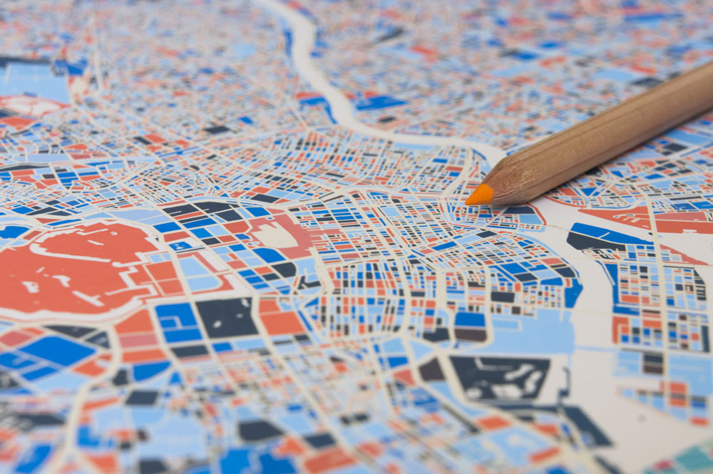
    , Modern Map Art – Deconstructing, fill...
    Created by David Hoe (Mini Cloud Studios) from London, and currently on Kickstarter, 'Modern Map Art Prints' is a collection of detailed maps transformed into colourful abstract art prints of anywhere in the world. The project celebrates the joys ...
    , Indirect Flights – Sprawling la...
    Raw materials, satellite images, organic textures, brush strokes and architectural fragments are all blended together into a dense Google Maps style panorama extending in all directions.
    , Playground NDSM – Interactive p...
    Created by Marc Faasse, Playground NDSM is an interactive photomontage that includes 7 years of photographs taken by Marc and mapped on the googlemaps.
    , Maps by Kim Asendorf – Colour a...
    Kim Asendorf uses Google Maps to explore incomprehensive complexity of landscape as colour and pattern.
    , Algorithmic Architecture by Charlie B...
    Created by Charlie Behrens, this short film is intended to encourage a creative audience to seek out Kevin Slavin’s talk “Those Algorithms Which Govern Our Lives”. It employs an effect which takes place in Google Earth when its 3D stre...
    , Livehoods – Use-based urban analytics
    Livehoods is a new project hatched within the School of Computer Science at Carnegie Mellon University that leverages 18 million Foursquare check-ins to draft up new urban 'activity zones' based on the patterns of frequent visitors. The venture es...
    , Mesh Grammars: Studies for a Dome by ...
    Mesh Grammars: Studies for a Dome is a project by Benjamin Dillenburger & Michael Hansmeyer trying to create “highly articulated architecture using a novel method of folding”. The duo designed a series of domes by folding a surface...
    , BKME.ORG – A Web Platform for Reclaim...
    At the best of times the relationship between cyclists and motorists is tense. Given that the amount of dedicated routes available to cyclists in many cities is quite limited, motorists that opt to stop or park in what should be a thoroughfare rea...
    , 100.000.000 Stolen Pixels [Scripts]
    100.000.000 stolen pixels is a personal project by Kim Asendorf in attempt to create an archive of numerous sites by ‘stealing pixels’ from them. A web crawler created by Kim started with 10 URLs (See first 10 in url.log) and searched ...
    , Distance and Common Desires [Cinder]
    Created by David Wicks, Distance and Common Desires is a series of prints created through analysis of submissions to Destinations. David filtered people’s responses to the questions “Where do you want to go?” and “Why do you want to go there?...
    , Time as Color and Place [iPhone]
    Originally created as net.art around 2000 and 2002, Time As Color and Time as Place are two projects by Christopher Otto now available in the form of iPhone applications. Time As Color is an app that displays time as additive colour where red is r...
    ,
    Authors @Mizuki, @Filip, @greg,
    Categories Member, Project,
    Chart
    Search Not enough results? Try: Search Term
    Go to articles
    Activity Log
    Join our Community to View/Add Comments.