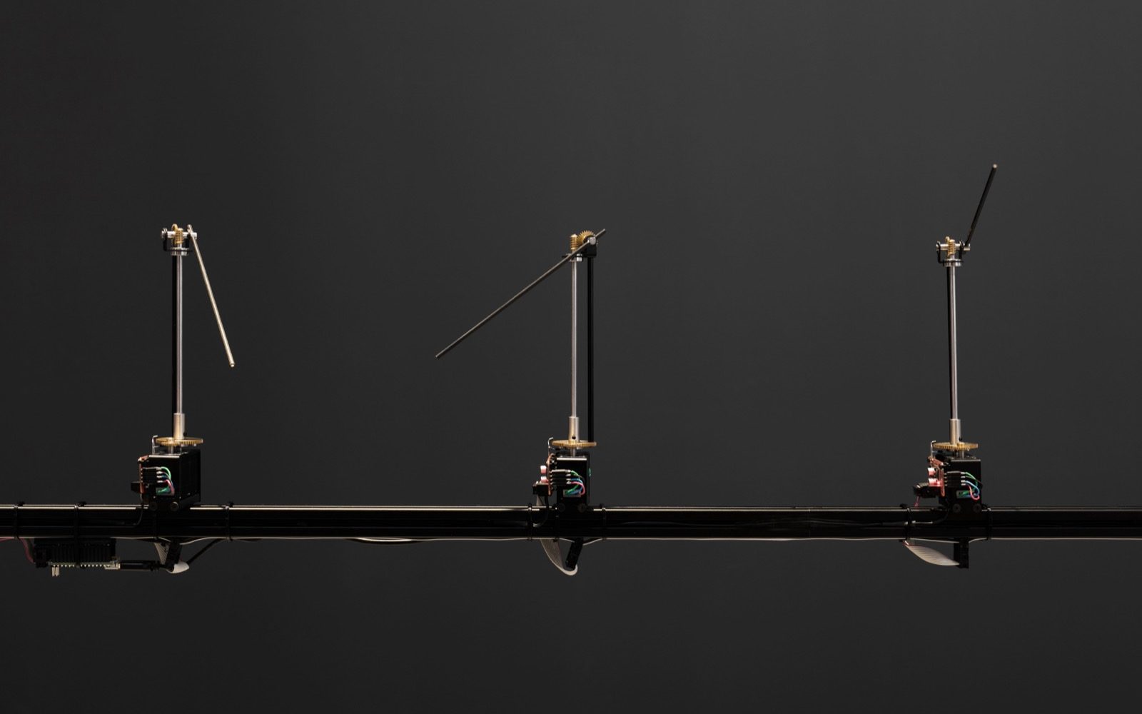
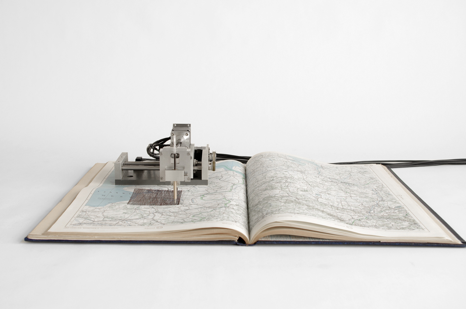
Created by Berlin based studio Quadrature, Satelliten is a custom-built machine that brings the invisible movement of passing satellites in lower orbit to a tangible medium and scale.
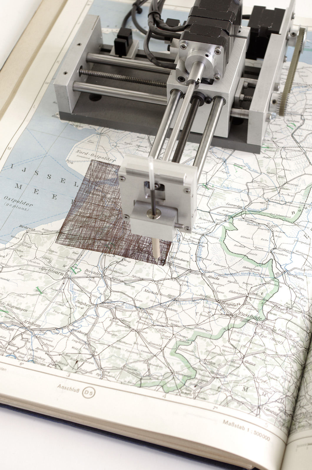
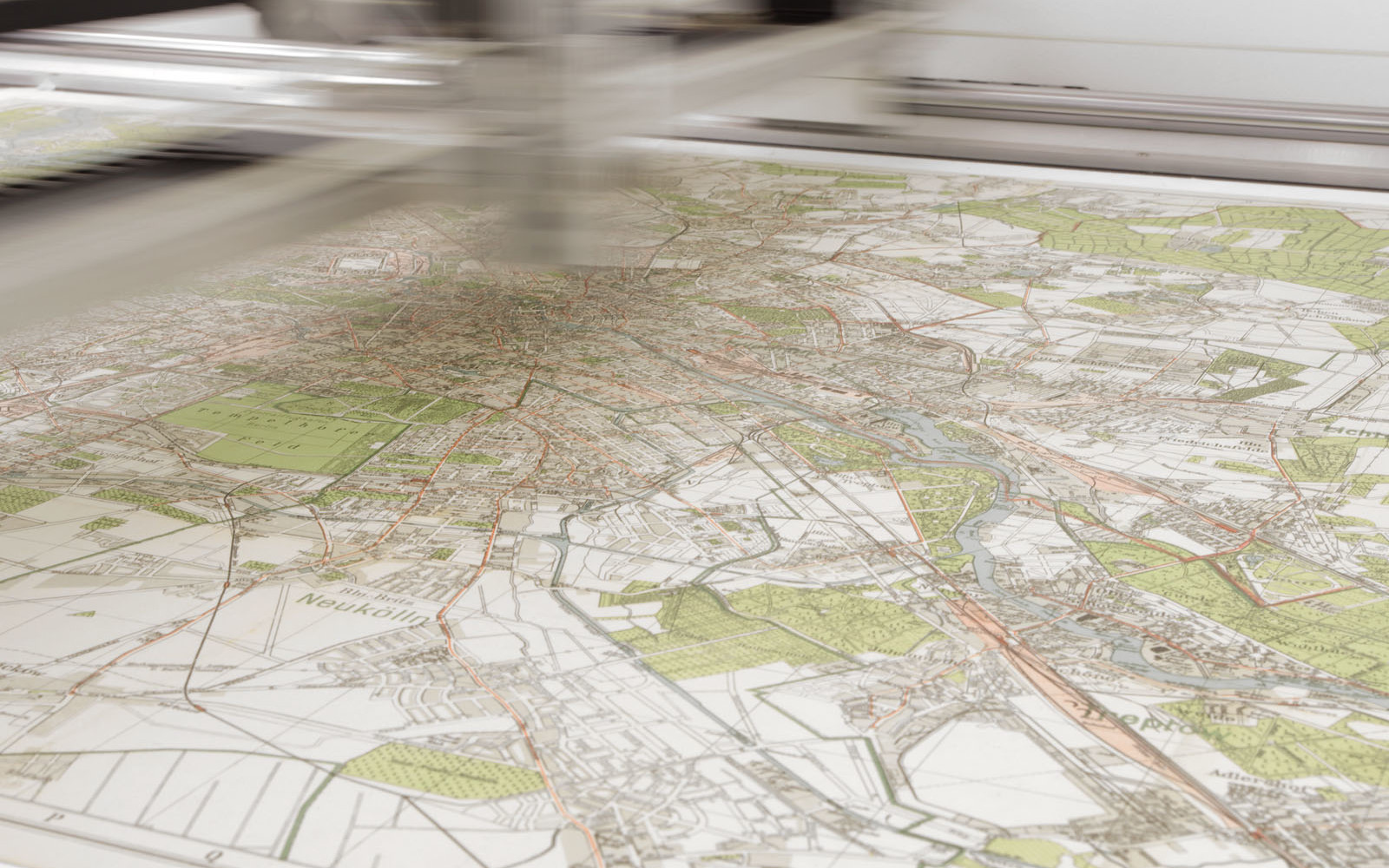
For a long time, maps and atlases used to be one of the only sources for geographical knowledge. Now the paths of the satellites start to form on top of the familiar neighbourhoods, thus setting the normally invisible traffic in relation to our usual habitat. But as time passes the lines of the satellites will obliterate the well-known streets and cities, overwriting not only the information the map originally contained but as well the marks left by the preceding satellites.
The paths these satellites form on top of the familiar neighbourhoods but majority of these objects revolve our planet in 200km to 2000km height, with an orbital period of 90 to 130 minutes and they are most of the time invisible to human eye. Their positioning data is well known and in a square of approximately 10cm², the Satelliten machine traces their lines in real time until the far away object leaves our horizon again. After a while only a black square is left forming a temporal window, showing the seemingly arbitrary but highly structured activities in lower earth orbit.
Created with Arduino and Raspberry Pi.